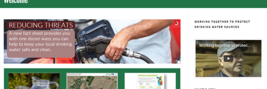
Interactive map, fact sheets on 25 local municipal well systems among new features of drinking water source protection website for Maitland Valley, Ausable Bayfield source protection areas
Upgrades to a local website include an interactive map to help people find out more about their local municipal wells. The Ausable Bayfield Maitland Valley Source Protection Region has updated its local website with added new features and content. The website is found at sourcewaterinfo.on.ca. It now includes pages and fact sheets about 25 municipal well systems. It also provides information about zones of protection around municipal wells and where planning policies require action by people living and working near those wells.
“Locally-developed source protection plans are now in effect to protect municipal drinking water sources,” said Jenna Allain, Program Supervisor with the Ausable Bayfield Maitland Valley Drinking Water Source Protection Region. “We have entered an important new phase of this work. We want to make it as easy as possible for people to find out about the municipal well in their community. We also want to make it easy for people to find out if source protection plan policies require them to take any action at their home or work.”
The website’s new home page provides three high-profile windows to find maps, fact sheets, and information about the Risk Management Office. There is also a news feed with current news about drinking water source protection in the Maitland Valley and Ausable Bayfield source protection areas.
The new interactive mapping feature shows the two watersheds as well as the names of several towns. There are dots on the map for each of the 25 municipal well systems of the region. People can click on these dots to find the name of the well and then click on a link for more information. By clicking on that link people can find a page about the community’s well, a detailed map of wellhead protection areas, and a fact sheet. The fact sheets let people know about the water source and treatment, explain the wellhead protection areas, and provide ways to protect these local drinking water sources.
The source protection region wanted a website that was modern, better suited to smart phones and devices, clean and uncluttered, and one that made it easy to find maps and policy impacts, according to Allain. The website changes also make it easier to find documents, she said, since tabs and drop-down menus have been added to the top of the page for easy navigation. New content on the website includes a new video showing the work that local people are doing to protect drinking water sources.
The upgraded website includes a page about risk management plans. A risk management plan (RMP) is a tool that regulates activities that pose a significant threat to municipal drinking water sources. Risk management plans include best management practices designed to reduce or eliminate risks to the municipal drinking water source. These RMP plans are generally negotiated between the person doing the activity and a municipally-appointed risk management official. For example, if fuel stored at a service station were a significant threat to drinking water sources, a risk management official would work with the gas station owner. Together, they would develop a risk management plan to reduce the chance of spills from an underground tank.
The Ontario Ministry of the Environment and Climate Change (MOECC) approved source protection plans for the Maitland Valley and Ausable Bayfield source protection areas on January 19, 2015. The source protection plans took effect in April of 2015. The plans include policies to address 21 activities that can pose a threat to municipal drinking water sources in certain circumstances (for example, in certain locations and in certain quantities).
Source protection plan policies address activities in four types of vulnerable areas: wellhead protection areas (groundwater) around municipal wells; surface water intake protection zones; significant groundwater recharge areas; and highly vulnerable aquifers. People may find the maps of these areas by visiting sourcewaterinfo.on.ca. Threat activities may be assessed as low, moderate or significant threats to municipal drinking water sources. In this region, significant threats to drinking water are only found in wellhead protection areas (WHPAs) A, B, and C. The policies in those relatively small vulnerable areas reduce risk by using tools ranging from education and outreach, to risk management plans, to restricted land uses, to prohibition of some activities.
If you are located close to a municipal well and would like to learn if plan policies apply to you, or how you can protect local drinking water sources, visit the website at sourcewaterinfo.on.ca or phone toll-free 1-888-286-2610 or email info@sourcewaterinfo.on.ca.


